Welcome!

Saturday, July 11, 2009

Saturday, July 11 - Our Lake and Headquarters Pass


This was my scariest day on a mountain ever...

I met my friend Melody, her sister Shonie, and Shonie's boyfriend Dave at the trailhead at 8.  We planned to hike the easy trail up to Our Lake and then Shonie and Dave were going to do the "ridge walk" over to Headquarters Pass and Melody and I were going to see how that looked.   So we meandered up to Our Lake, which is just a beautiful, pleasant little bowl in the mountains. It was a nice, easy hike up.  This is one of the "bumper crop" years for Beargrass...it happens about once every 7 years that there is a TON of it and this is the year (and we were in MT 7 summers ago and I remember how much there was that year too).


Dave brought his dog, Brit (the lab) and he was dogsitting Hobbes while the family was in Glacier (yes, there is a little boy who is 7  :)    ).  I was thrilled to hike with dogs!  Here they are enjoying one of the snowfields:


Here is the lake's outlet:


A pretty lake, pretty valley, wildflowers, beautiful mountains in every direction.

Melody, Hobbes and me:


Shonie and Dave wanted to fish so Melody and Hobbes and I walked westward from the lake to explore.  I had fallen in love with Hobbes by then...he is one cool dog, very smart, very sweet.   I climbed up on this boulder (the only good way up is at the highest end) and took this picture looking back east:

and I heard something behind me.  Hobbes had clawed his way up onto the boulder!  He seemed quite pleased with himself.


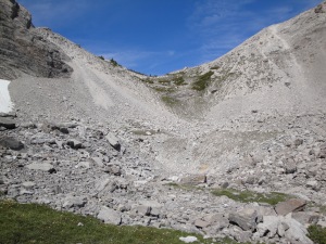
We wandered up a little farther toward the saddle and thought about going up there but because of the scree/talus decided not to as we thought Shonie and Dave were going to want to head out.
DSC00523


This is a different talus slope to the north.  This would take a LONG time to climb:


We started back toward the lake and then a black bear appeared up on the saddle ridge...seemed like something had spooked him from that side but then he must have seen or heard us and he seemed uncertain where to go. He finally went back over to the other side.  We were glad Hobbes didn't see him.  Cute little bear...probably only 2 or 3 years old.
Tired out dog...he was running way up and behind and around us on the trail the entire day.


Brit quickly learned I was always good for a tummy rub...she's a sweet dog and it's amazing she's a great hiker/climber at age 10!


Scenery near Our Lake:


We saw a "sun dog"...my first. I took a picture by holding up my sunglasses and putting the camera lens up to the sungasses lens:

The group having lunch.


We left the lake and met a law enforcement ranger lunching up off trail...they have to wear bullet-proof vests even up there!   We then bushwhacked up a mountain above the lake. I was literally using trees to pull myself up.  It was a little scary but I was ok, I just took it one step at a time.  I was very happy with myself once I got up to the top.  I thought the hard part was behind us.  I had no idea the worst was yet to come. I had initially thought Dave had done this off trail climb before but he hadn't.  We saw about 10 mountain goats up there including some "kids"...very cute and nice to see them wilder than they are at Logan Pass (Glacier).  I found this interesting rock and Melody suggested I tell Jack it is a fossilized track of a "square toed behemoth".


Going up:


Looking down on Our Lake from above:


You can see some of the southernmost peaks of Glacier from up there!


It's a beautiful, high mountain saddle...


After leaving the saddle, Dave and Shonie went up to see the view from the ridge and Melody and I took off across a huge talus slope.  Talus is chunks of rock.  The problem was, this stuff seemed very, very unstable and I would have times where every rock I touched moved. This makes you feel (if you're me anyway) that the whole mountainside is going to slide down and take you with it.  It is very slow going and it was terrifying at times.  You can't do anything except keep going, yet you don't want to move because you're so scared.  I couldn't even enjoy the views. It took us hours and I bet we only went a half to 3/4 of a mile.  We thought we were close a few times and then had to keep going down more slopes that were even steeper.  Plus, the mosquitos were pretty bad.  We can't figure out what they are doing up so high.  Once when I was having a bad moment after we'd met up with Dave and Shonie and the dogs again, Hobbes came down to say "hi" and licked my face.  I gave him a HUGE hug...I needed that at that point!


Fossil High on a Mountainside

We finally reached the pass hours and many bruises and scrapes later (the rock is a very coarse, gritty limestone - full of fossilized coral and shells and things) and it really takes a toll on your skin and your boots.  This pass is the boundary/entrance to the immense Bob Marshall Wilderness.  For those who are familiar with it, you can see the Chinese Wall in the distance:


One of the steep ridges we had to descend.


We made our way down from the pass and along a pretty trail back to the cars.  We saw about 10 more goats along the way. Hobbes kept scaring us because he'd disappear and then you'd see something brown running and think "bear!" but it would just be him.  I've never seen Indian Paintbrush this red before:


We saw some very pretty waterfalls on the way out.


On the  drive back to Choteau I saw what appeared to be a very confused young bull elk...he was way out on the prairie. I saw him and stopped a ways back and he jumped a fence, stood in the road a while, then jumped another one and then went loping off across the prairie, away from the mountains.

It was a great, scary, challenging, exhausting day.  Last night I felt like I'd lost all the confidence I'd gained in my abilities as a mountaineer.  Today I'm not sure...I guess I'll find out soon though!
© 2009 Tara Morrison

Friday, July 10, 2009

Friday, July 10th - Choteau

July 10, 2009

I was up bright and early, packed up and then watched “Tour” coverage with Ralph while I tried to work on my blog.  Then I left and drove out to Cave Mountain campground to set up my camp for the night.


Cave Mountain Campground - Rocky Mountain Front

DSC_0707
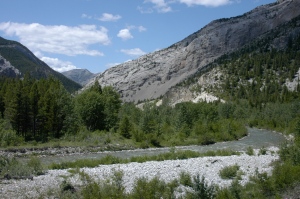
West fork of the Teton River
DSC_0715
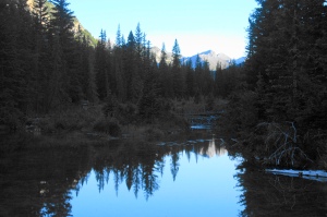
Pond Near the Campground

The campground is way back into the hills/mountains along the front,  remote and pretty.

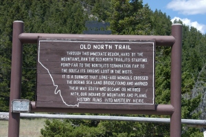
The "Old North Trail" ran along these mountains.  I'm very intrigued by it and would love to see evidence. Unfortunately, most of the places they have physical signs of it are on private land.

DSC_0709

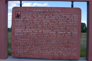
North of Choteau is the site of an old Indian Agency that Ralph's wife has studied very intensely.

DSC_0711

Here is the site:

DSC_0713

I reorganized the car (again) and hung out and read for a while (I haven’t had much time to do that).  Then I came into town, Choteau, and it took a good 40 min. to drive in.

Here's where we hiked yesterday, the ridge on the right (Ear Mountain is on the left):

DSC_0716

Closer view of Metis Ridge:

DSC_0719

 I couldn’t get a cell phone signal anywhere (this is the only town I ever have trouble in) and finally gave up and started asking around for a pay phone, after driving around looking in vain.  The lady at the info. building (nice dinosaur and local history display) sent me to the Exxon station.  The gas station owner said they no longer have one and offered to let me use his cell phone but I didn’t want to do that since it wasn’t going to be a quick call (the kids) so he told me to go to the pavilion in the county park.  I went to the pavilion and was told there no longer is one there and no one knew of any in town but one lady insisted I use her cell phone when her husband got back.  They were getting ready for a family reunion. We chatted and they told me a little of the family history and then the phone arrived so I called home briefly.   I thanked her profusely and we chatted some more and as I was going to leave they invited me to stay and “reune” (reunion) with them and they were serious.  I thought about it…it could be really interesting!  But I really needed to get this updated and want to get back to camp for a fire.  Another thing I love about small towns…inviting a stranger to a family reunion!  I also would like to know why so many people over 60 call me “honey”.  Do I look really young for my age?  I didn’t think so but this has been happening a lot.  It makes me feel like a kid. I should be happy about that I guess!

I’m now at the Elk Country Grill in Choteau because they have WIFI (but no pay phone) after using the library’s WIFI for a while.  Every 10 minutes they have a bugling elk playing.  You can also bring the giant, stuffed moose to your table with you if you’d like (I didn’t).
© 2009 Tara Morrison

Thursday July 9th - Metis Ridge hike

Ralph and I were on the trail around 8 a.m.  Our destination was an officially unnamed ridge near  Ear Mountain, one of the landmarks on the rocky mountain front - it used to be a vision quest site.  Ralph and Nancy are trying to get the ridge named Metis Ridge after the people who lived in the area.  Our starting elevation was about 5250 ft.

We parked on the road since it was a loop hike and we wanted the truck there when we finished hiking (better to hike the extra road mile at the beginning instead of at the end).  We walked down the road the road for a while, then had to cross a river (south fork of the Teton).


We hiked in the forest at first for a mile or maybe a little more,  and there was a LOT of scat on the trail…at least half of it was wolf, some very fresh; some probably bobcat and we also saw what I’m pretty sure was a bobcat track in the mud.  Eventually we came out into a beautiful valley and stopped for a break.


We thought we saw an old cabin site, some rocks that didn’t look natural but once we made our way over there, it looked like they were naturally there.


Then we started heading up, mostly using game trails.  It was pretty steep at times. Our first goal was a saddle between two ridges.  We made it there and had some great views but there were more to come! 


We worked our way down and around one ridge to Metis.  Then it was a LOT of uphill.  Great leg workout!

One of the coolest things about the day was the discovery of a collapsed cave.  First we just saw a big hole in the mountain.


Then we saw the stalactite and flowstone.


 It was amazing, to see something like that near the top of a mountain!  It made a nice rest break too.  After exploring that for a while we continued asceding to the top of the ridge.


Ralph lunching on the summit looking east with the plains in the background.


Looking up at Ear Mountain. Next time I'm going up there!


Me at the summit of Metis Ridge - the view is to the North

Looking West from the summit of Metis Ridge


This is looking north along the ridge (looking at it now I think "YIKES!").

What spectacular views!  Even though it was cloudy and hazy, we could see across the plains to the Big Belts which are SE of Great Falls, MANY miles away; we could see peaks in the middle of the Bob Marshall Wilderness and far to the north, possibly a few very small, faint peaks that may be in Glacier.  Ralph said on really clear days you can see the Bear's Paw Mountains from there and they must be a few hundred miles away, by Havre.  This is where I ran out of adjectives to describe the beauty and the views…it was incredible!  I didn’t go up and look over the edge like Ralph did but I got pretty close…for me anyway.  The elevation at the top was about 8400 feet so we had a 3000 foot elevation gain.    Ralph was very happy the weather cooperated and this route worked...he had been to Metis Ridge via the route we took down, and he'd been up the first valley to the high saddle, but he had never done this as a loop hike.

We then started a long, long descent through talus and scree..very slow going to make sure you weren’t stepping on rocks that were going to roll, you just have to be very careful where you put your feet.


I discovered there are a lot of fairly large, creepy black spiders up there...and very tiny RED ones.

Looking back up at where we'd been.


Once we finished the long time desceding the rocks it was time to bushwhack down  a valley with no trail except game trails.    That is slow going but there was a beautiful waterfall at the end.   It can be pretty hard to find your way through at times, the brush/trees are pretty thick in there.


I learned a new plant...this is a Miner's Candle. It's a triannual...it comes up 3 years and the third year it has a spike flower that goes up...then it dies.  We also saw a plethora of Lady's Slippers.

After some tough bushwhacking we crossed the river again and were done. It was a long day, on the trail at about 8 and out around 6:30, but it was a fabulous hike – so much fun and so beautiful!  Thanks again, Ralph, for a great, adventurous day!  Wildlife sightings of the day:  not many…one sheep and a few snoeshoe hares.  Some bear sign, some wolf sign but unfortunately no bear or wolf sightings.  Maybe next time...I've only begun to explore the Rocky Mountain Front!
© 2009 Tara Morrison

About Me

My photo
Minnesota
Adventures on the road with (and sometimes without) my kids. Check back soon for the infamous Summer of 2008 trip (aka: how many flat tires can one mom have in a single trip?) and more! This blog goes in reverse...older trips being added weekly. Please sign up for the RSS feed so you will know when there are updates. Or, email me to be put on an update list!